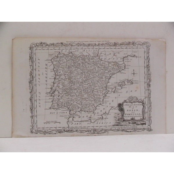
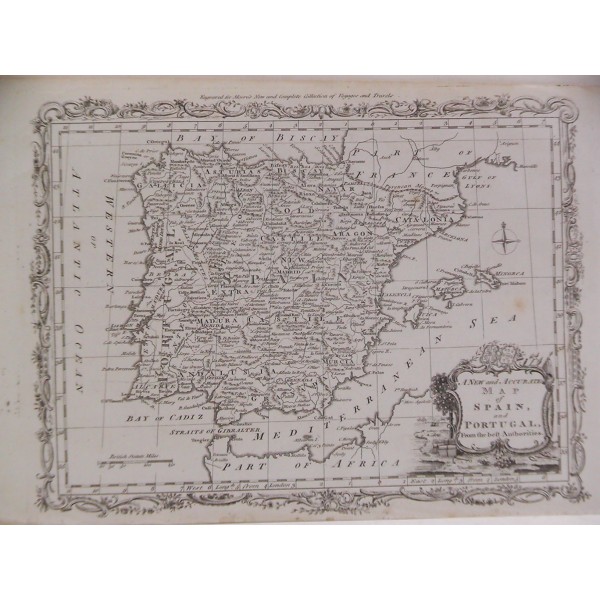
A NEW AND ACCURATE MAP OF SPAIN AND PORTUGAL

BRION DE LA TOUR (1756 – 1823)
A NEW AND ACCURATE MAP OF SPAIN AND PORTUGAL
From the best Authorities
BRION DE LA TOUR (1756 – 1823)
A NEW AND ACCURATE MAP OF SPAIN AND PORTUGAL
From the best Authorities
[ Mapa de España y Portugal. Península Ibérica]
Grabado al cobre, ca. 1780; por Louis Brion de la Tour (cartógrafo Real del Rey de Francia, "Ingenieur-Geographe du Roi").
"Engraved for Moore's New and Complete Collection of Voyages and Travels"
Medidas grabado: 21,8 x 28,5 cm; papel: 23,3 x 36,2 cm. Buen estado.
