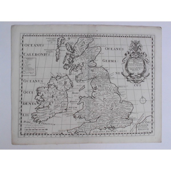
A New Map of the BRITTISH ISLES

WELLS, Edward (1667–1727)
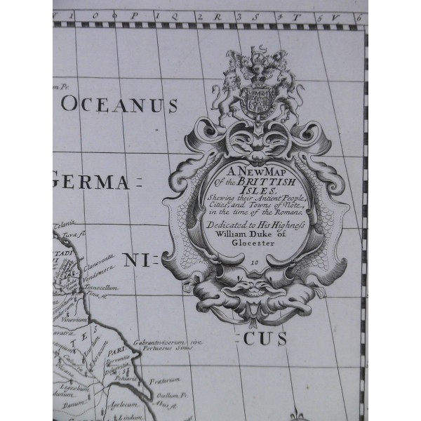
A New Map of the BRITTISH ISLES Shewing their Antient People, Cities, and Towns of Note, in the time of the Romans
Dedicated to His Highness William Duke of Glocester
WELLS, Edward (1667–1727)
A New Map of the BRITTISH ISLES Shewing their Antient People, Cities, and Towns of Note, in the time of the Romans
Dedicated to His Highness William Duke of Glocester
Grabado al cobre, 1701; pliegue central; 2 perforaciones reparadas. Buen estado. Medidas grabado: 37,2 x 49,2 cm; papel: 43 x 54,5 cm.
Mapa del cartógrafo Edward Wells (profesor de matemáticas y geografía en el Christchurch College, Oxford University), dedicado a su alumno William Duque de Gloucester, fallecido en 1700, el año de la primera edición; cartela decorativa con el escudo de armas del Reino Unido. Mapa muy apreciado, formaba parte de un conjunto de 22 mapas del atlas "A New Sett Of Mapps Of Ancient And Present Geography ..."; grabado por Sutton Nicholls
[ Mapa de Gran Bretaña ; Great Britain ]
